A waterfall earned on foot
Plan the official 7 km forest route from Chakvistavi with the waterfall, lake, damp-footing precautions and park visitor information.
Tsablnari is a genuine forest walk: choose it for Mtirala's subtropical vegetation and marked trail, with the waterfall and lake as destinations along the route.
- Area
- Mtirala National Park · Chakvistavi, Adjara
- Official trail
- Tsablnari/Chestnut Forest: 7 km, one day, pedestrian, graded easy by the Georgian Agency of Protected Areas.
- Overnight base
- Batumi — compare options ↓
Area search, not a confirmed venue entrance. Use the guide's visitor details for the final approach.
In this guide
Tsablnari Waterfall: Hiking Mtirala National Park's Chestnut Trail
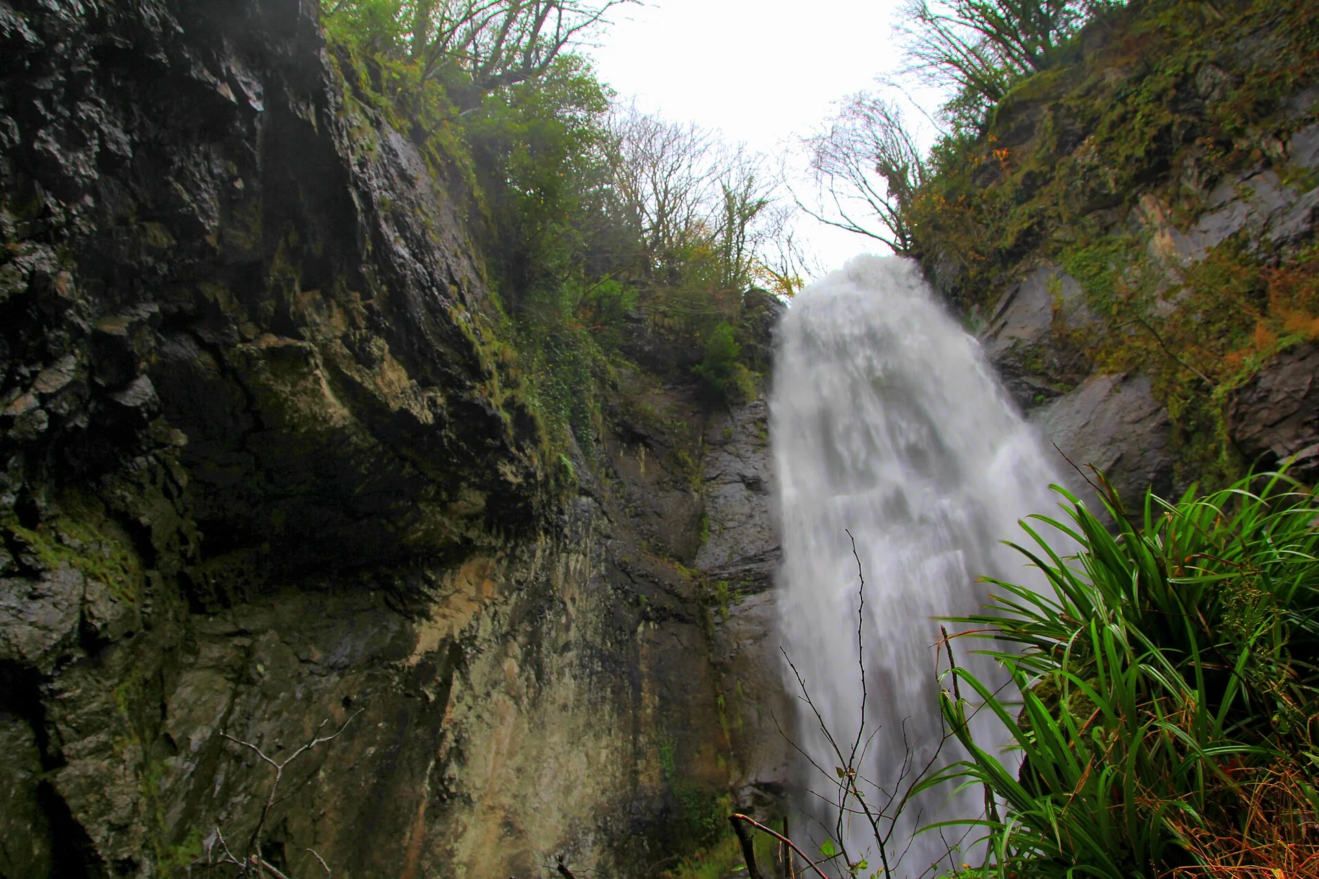
Tsablnari, meaning the Chestnut Forest Trail, is one of the official hiking routes through Mtirala National Park. Its waterfall is reached on foot from the visitor centre in Chakvistavi, far removed from the idea of pulling over beside a roadside cascade. The Georgian Agency of Protected Areas classifies the route as an easy, one-day pedestrian trail of about 7 kilometres and places the waterfall approximately 2 kilometres from its starting point.
Mtirala receives substantial rainfall, giving the forest its deep green undergrowth and its Georgian name, often interpreted as 'crying'. This humidity is also a planning issue: slippery earth, streamside stones and changing weather can make an officially easy route tiring. The reward is the river gorge and remarkable vegetation around the path, not a promised swim or a high-speed tick on a waterfall checklist.
Start at the correct visitor centre
The protected-areas agency distinguishes the park's administration office in Chakvi from its actual visitor centre in the village of Chakvistavi. It places the visitor centre around 15 kilometres from the administrative building, and the Tsablnari trail begins there. A search result for 'Mtirala National Park' can point to the wrong part of the park if the next step is a walk to the waterfall. Set the destination specifically to Chakvistavi visitor centre and confirm the current access road before leaving your accommodation.
Check in with park staff for trail conditions, route details and which services are operating. The agency describes local guidance, visitor facilities and transport assistance, while published service pages also list optional adventures. Do not assume a zipline, river crossing mechanism, rental or café will operate on the day. A simple marked hike can be enjoyable on its own; any activity requiring staff, equipment or payment should be verified separately.
Understand the full 7 km route
The official Tsablnari description identifies a 7-kilometre one-day pedestrian route, passing both a waterfall and a lake between roughly 265 and 442 metres in elevation. The trail follows the Chakvistskali River gorge before moving through forests with cherry laurel, Colchic box trees and ivy. The agency puts the waterfall about 2 kilometres from the visitor centre; this is a distance to a feature along the route, not the total length of a complete outing.
For that reason, do not build your schedule by doubling a single 2-kilometre figure or assuming the lake is accessible by the same short turnaround path. Ask the visitor centre whether your intended version is the full official loop or a shorter return to the waterfall, and whether any section has changed after rainfall or maintenance. Bring an offline trail map, start with ample daylight and preserve time for rests and slow photography rather than committing to a fixed minute-by-minute hiking target.
What the waterfall and riverside actually offer
The Agency of Protected Areas describes a waterfall of about 15 metres along the trail, surrounded by ivy and characteristic Colchic vegetation. Other tourism pages publish a different height, which illustrates why an exact number should not drive expectations. There are designated picnic and camping spaces in the general waterfall area according to the agency, along with a river passing between rocks. Facilities may be closed, reserved or subject to park rules; check before planning a cookout or overnight stay.
The same official description mentions a whirlpool where the river flows around rocks. That is a reason to be particularly cautious around natural pools, especially after rain. The lake on the route is another landscape feature rather than an assurance of supervised swimming. Enjoy the water from safe ground, respect signs and do not climb wet boulders for an unobstructed photograph. A sheltered picnic or a break with a view is a sounder plan than treating the river as a swimming facility.
Choose the right weather and equipment
Mtirala's forest is humid enough that a trail may be slick on days when Batumi's seafront appears dry. Walk in grippy footwear, carry a light waterproof layer and protect a phone or map from rain. Water, a snack and a small first-aid kit help make an ordinary day route manageable. Some paths may have roots and uneven natural surfaces, so the agency's 'easy' classification should not be read as wheelchair accessibility or a guarantee suitable for every level of mobility.
The park administration suggests spring, summer and early autumn as favourable general seasons, but day-to-day conditions take priority over the calendar. Ask about closures and hazards before hiking after heavy rain; avoid flooded crossings and turn back if the route is unsafe or daylight runs short. For visitors travelling with small children or companions who do not enjoy sustained walking, choose Makhuntseti or a suitable Mirveti village visit on another day. Tsablnari is best when the hike itself is the main event.
Plan the visit and the journey back.
- Official trail
- Tsablnari/Chestnut Forest: 7 km, one day, pedestrian, graded easy by the Georgian Agency of Protected Areas.
- Start here
- Chakvistavi village visitor centre; the Mtirala administrative office is separately located in Chakvi.
- Waterfall point
- The agency places a roughly 15 m waterfall about 2 km from the visitor centre; the whole route is longer.
- Check conditions
- Ask park staff for the current marked route, weather-related closures, map and any transport or facility arrangements.
- Bring
- Grippy walking shoes, rain layer, drinking water, offline route information and enough daylight for a full forest outing.
- Water hazard
- The river includes rocky flow and a whirlpool; do not infer safe swimming or crossing from the presence of a lake or picnic facilities.
Area search, not a confirmed venue entrance. Use the guide's visitor details for the final approach.
Stay where the next day makes sense.
Compare the base first, then check the property's location and transport for your outing.
Batumi
Keep a coastal city base and arrange an out-and-back trip into Adjara's hills.
Compare directory stays →Search Batumi on Booking.com ↗Useful answers before setting out.
How long is the Tsablnari waterfall hike?
The official Chestnut Forest Trail is 7 km and categorised as a one-day easy hike. The waterfall lies approximately 2 km from the starting visitor centre, which is not the full trail distance.
Where does the hike start?
At the Mtirala visitor centre in Chakvistavi village. The park's administrative office is in Chakvi, a different location, so check your navigation pin.
Do I have to walk the entire circuit to see the waterfall?
The waterfall is described as a feature around 2 km from the visitor centre, but ask park staff which return options are currently approved and open. The agency also lists the lake on the full route.
Can I swim at Tsablnari?
The official trail description includes a river whirlpool and rocky water. That is no endorsement of swimming; follow restrictions and treat currents, slippery footing and recent rain as serious hazards.
Is Tsablnari easier than Makhuntseti?
No in terms of walking commitment: Mtirala's official route is a 7 km forest hike, whereas Makhuntseti is promoted as a comparatively accessible roadside-village excursion. Individual terrain and weather still matter.
Confirm the current visitor details.
Access, weather, opening hours and bookable experiences can change. Check the relevant operator or visitor authority for your date.
- Agency of Protected Areas — Tsablnari Chestnut Forest Trail ↗
- Agency of Protected Areas — Mtirala Park Administration ↗
- Agency of Protected Areas — Mtirala Visitor Services ↗
- Visit Batumi — Hiking in Ajara ↗
Photograph sources and licenses
Tsablnari waterfall in Mtirala National Park behind Batumi. Photograph by Kober. Source photograph, CC BY-SA 4.0. Converted to WebP, resized for web delivery. Responsive copies resized and compressed to WebP.
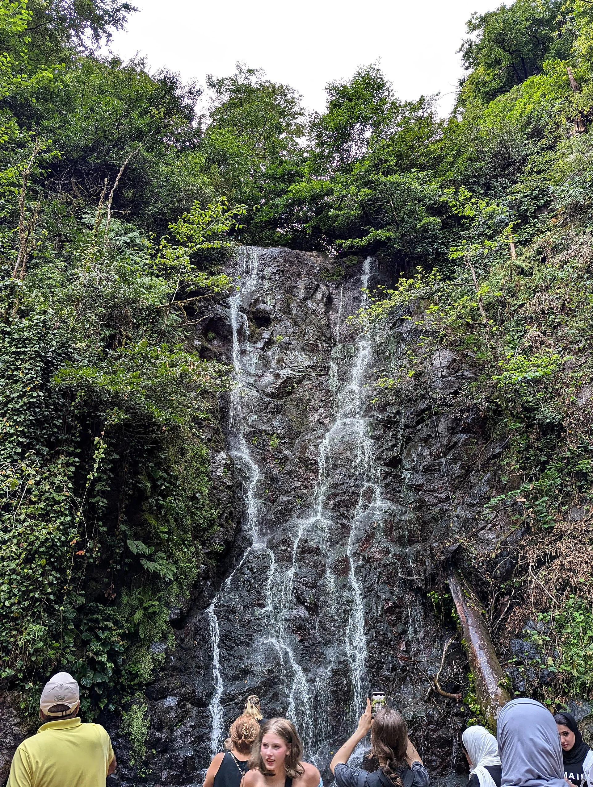
Makhuntseti waterfall spilling over a forested rock face in Adjara. Photograph by Wojciech Biegun. Source photograph, CC BY-SA 3.0. Converted to WebP, resized for web delivery. Responsive copies resized and compressed to WebP.
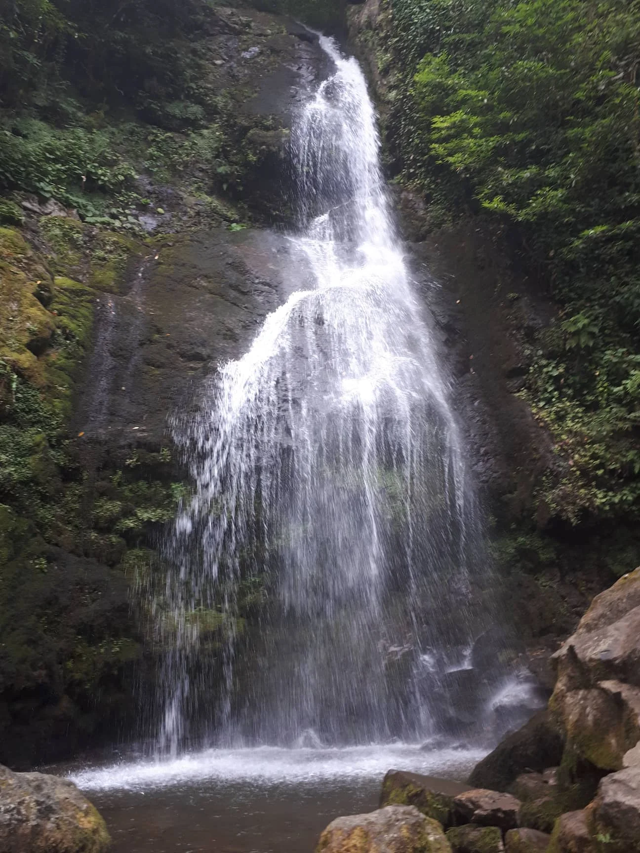
Mirveti waterfall in a green Colchic forest corridor near Batumi. Photograph by FingerWiki. Source photograph, CC BY-SA 4.0. Converted to WebP, resized for web delivery. Responsive copies resized and compressed to WebP.
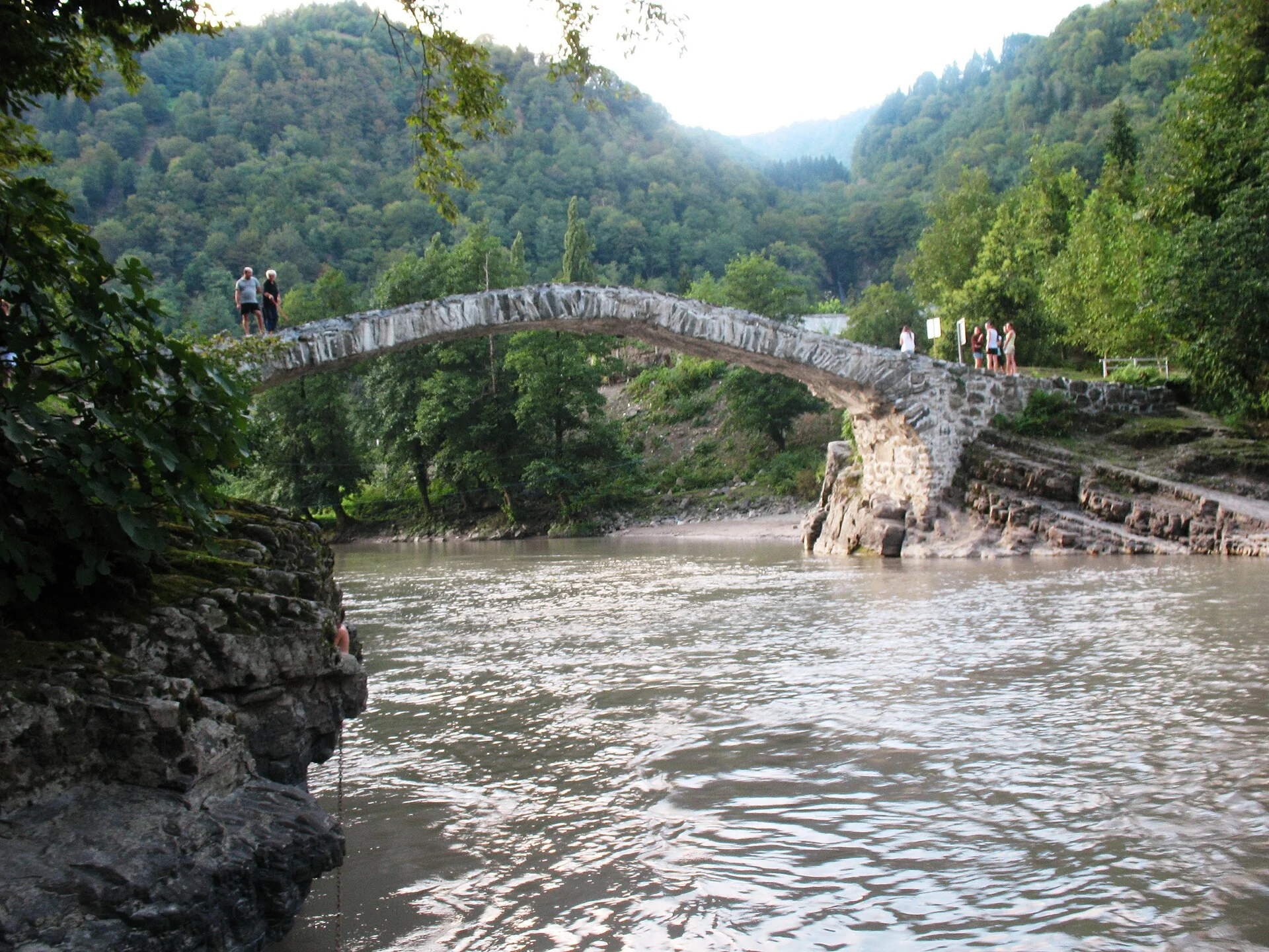
Old stone arched Queen Tamar bridge near Makhuntseti village. Photograph by G.N.. Source photograph, CC BY-SA 3.0. Converted to WebP, resized for web delivery. Responsive copies resized and compressed to WebP.