Two valleys, one sensible plan
A practical Batumi-based itinerary that prioritises the two village waterfalls and gives Mtirala its own proper hiking day.
For one vehicle-based day, prioritise Mirveti and Makhuntseti with their stone bridges; give Mtirala's 7 km Tsablnari forest route a separate day.
- Area
- Batumi and inland Adjara
- Book transport
- Confirm return travel, which village entrances are accessible, stops included and driver waiting arrangements.
- Overnight base
- Batumi — compare options ↓
Area search, not a confirmed venue entrance. Use the guide's visitor details for the final approach.
In this guide
Adjara Waterfall Road Trip: Mirveti, Makhuntseti and Mtirala
Batumi makes a flexible base for Adjara's waterfalls, but the most tempting names do not form a single effortless sightseeing circuit. Makhuntseti sits inland in Keda municipality along the Acharistskali valley. Mirveti lies in Khelvachauri municipality in the Chorokhi valley. Tsablnari belongs to Mtirala National Park, where the waterfall is part of a 7-kilometre walking trail from the Chakvistavi visitor centre. Their map pins hide very different amounts of walking and transfer time.
This is a road-trip plan designed around those differences. Use one day for two well-chosen villages, stone bridges and a relaxed meal, with enough slack for local access conditions. Reserve another day if the rainforest hike is important to you. The point is to have time to notice the places rather than turn them into a list of brief photographs from the same vehicle.
Day one: follow the inland river-valley corridor
Begin from Batumi with transport arranged for both Mirveti and Makhuntseti, and ask the driver to verify the final access roads before departure. Mirveti is about 22 kilometres from Batumi according to Visit Batumi, while Makhuntseti is approximately 30 kilometres away in another municipality. These are approximate distances from the city, not a promise that the waterfalls themselves are only eight kilometres apart or that the connecting drive is a straight line.
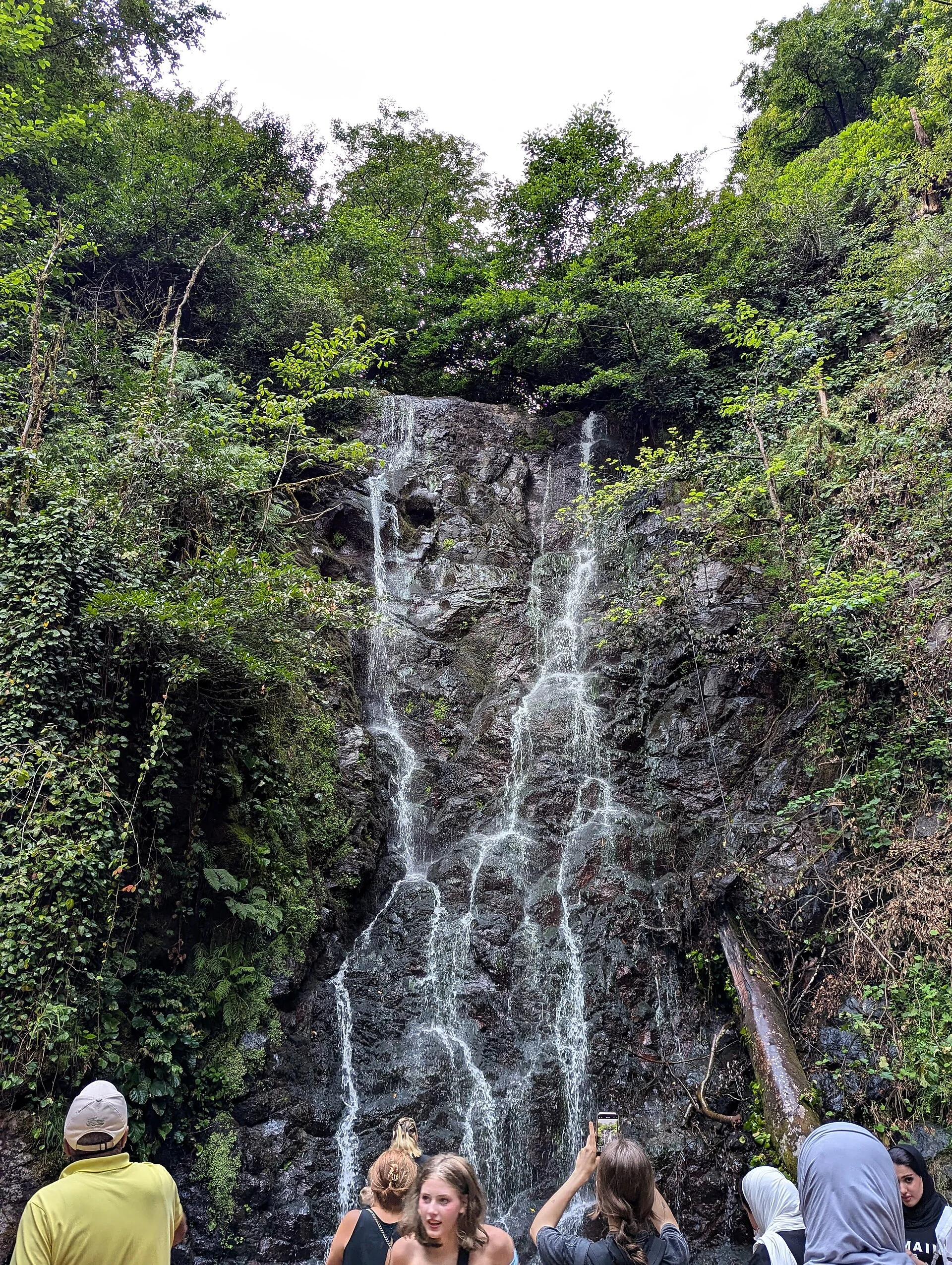
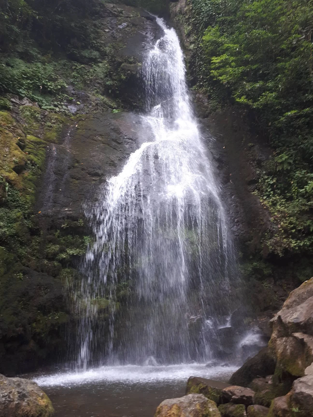
A practical sequence is Mirveti first, while you have energy to walk through the Colchic boxwood grove and explore its medieval arch, then Makhuntseti for its taller waterfall, medieval Queen Tamar Bridge and food options. Reverse the order if current road conditions or your driver make that sensible. In either direction, allow for village footpaths, photo pauses and the possibility that heavy rain makes a particular stop unsuitable.
Don't treat the bridges as incidental landmarks
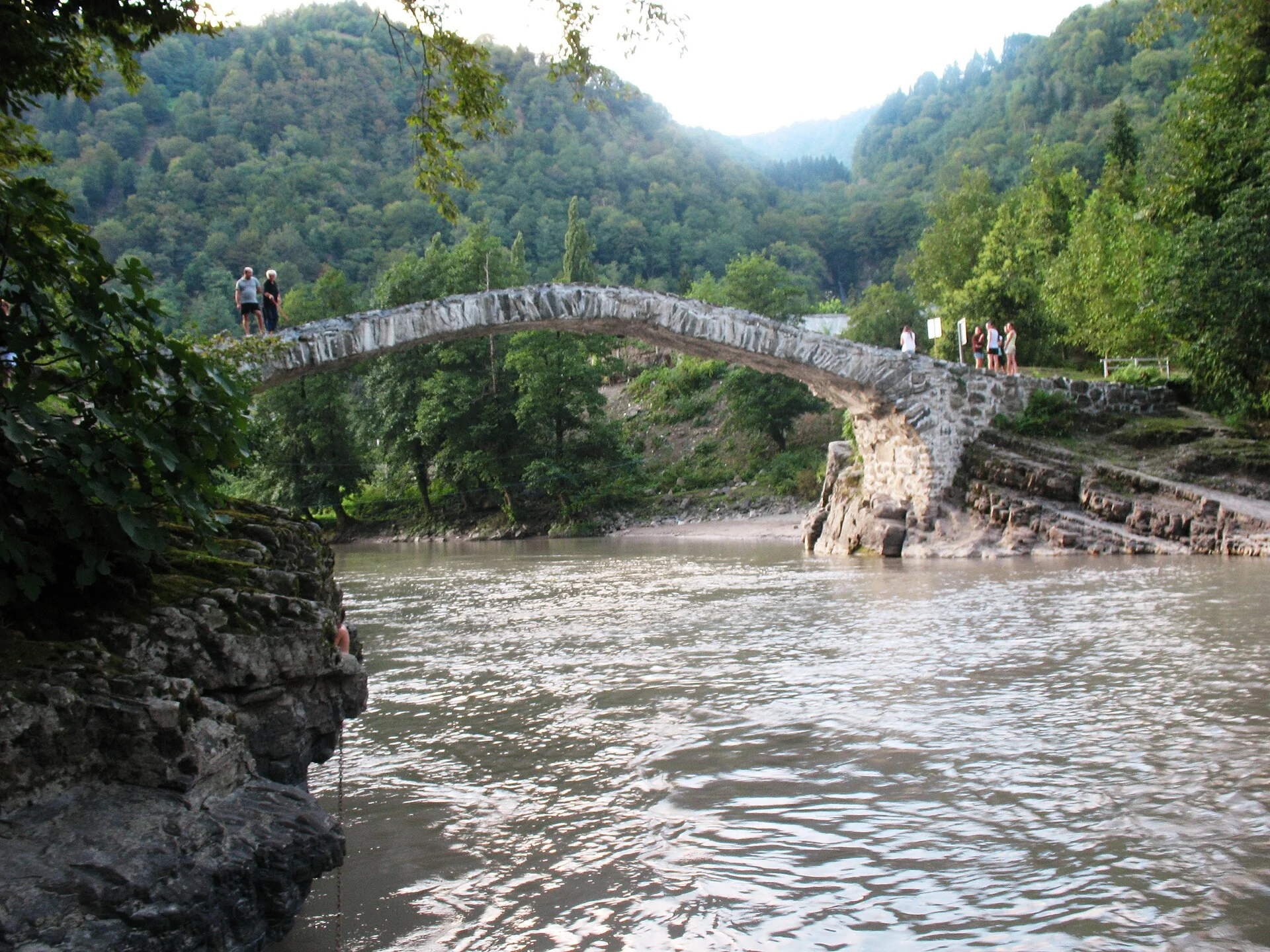
A standard waterfall tour may give you a quick photograph at each cascade. The medieval arches turn this outing into a useful journey through the history of Adjara's valleys. Visit Batumi identifies a thirteenth-century arched bridge near Mirveti and the twelfth-century Makhuntseti bridge over the Acharistskali. At Makhuntseti the bridge has a reported span of 28.7 metres and is built of volcanic stone. Together, the crossings show the practical challenge that mountain rivers posed to communities and travellers.
Budget for a separate walk to each bridge rather than assuming that a waterfall parking stop places you at its best viewpoint. Respect the age and condition of the stonework: keep away from unprotected edges, do not climb for photos and do not enter fast rivers below the arches. These are heritage features still situated in living landscapes. Where a passage is blocked, flooded or under maintenance, accept a distant view instead of creating a risky shortcut.
Make food and transport deliberate parts of the route
A village lunch is useful here because Keda is known for local cuisine and regional wine, and Visit Batumi mentions small cafés and picnic places near both waterfall settings. Ask about actual opening and serving arrangements on the day; a seasonal restaurant or roadside stall is not guaranteed to operate year-round. Carry drinking water and snacks so a closed café does not turn into a problem, and allow sufficient time to eat without sacrificing the second village.
Choose your transport around the return leg as carefully as the outbound one. A driver booked for an agreed set of stops is often more practical than expecting an app taxi from a remote trailhead, while self-drivers should confirm road quality and parking conditions themselves. A group with limited mobility should check the actual walking surfaces and drop-off points: road-accessible does not mean step-free at the base of a waterfall. A leisurely single-stop outing may be the better choice if these constraints are significant.
Day two: give Mtirala the time a national park deserves
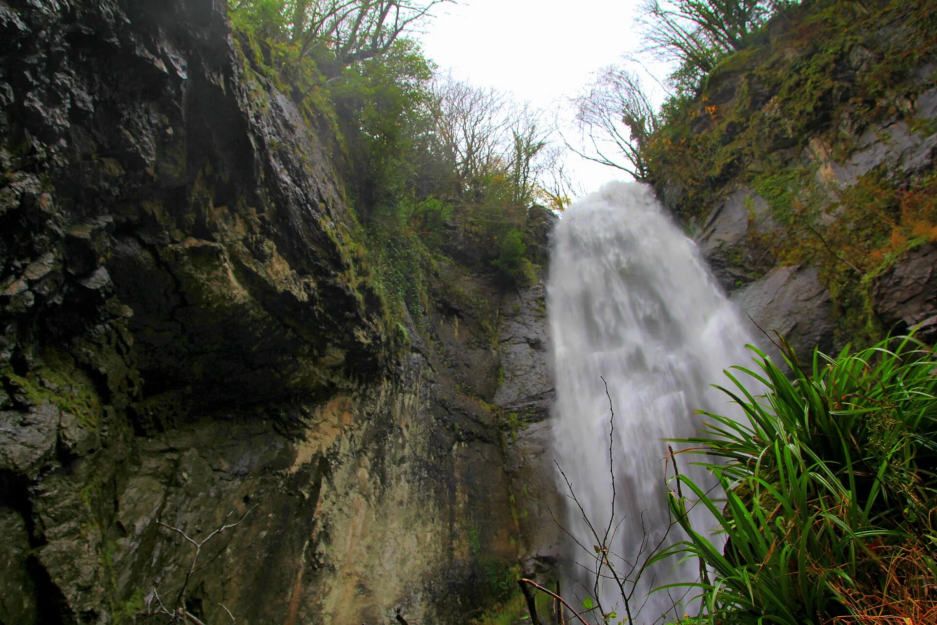
Mtirala should be a distinct forest day rather than an ambitious final add-on to Mirveti and Makhuntseti. The Agency of Protected Areas places the Tsablnari trailhead at the Chakvistavi visitor centre and describes a 7-kilometre one-day route, passing a waterfall about 2 kilometres in and a lake elsewhere along the route. The park's administrative office is in Chakvi, so checking the correct visitor-centre destination prevents a frustrating navigation error.
Contact the park before departure for trail conditions, access instructions and any current facility or activity restrictions. The forest is humid; suitable shoes and rain gear matter more than a rigid timetable. A scenic drive followed by a complete marked hike can comfortably be the substance of that day. If weather makes the path unsafe, choose an alternative local activity rather than risking a river crossing or improvising on a closed trail.
How to adapt the itinerary to your actual trip
With only one half-day, select Makhuntseti for a classic waterfall-and-bridge outing or Mirveti if woodland and a quieter village walk are your priority. With a full day and suitable transport, try both, while remaining ready to drop one if conditions worsen. With two days, add Mtirala for a wholly different experience in wet Colchic forest. These are three sensible versions of the trip, rather than increasingly pressured attempts to fit every stop into one excursion.
Batumi remains the simplest sleeping base when you want to return to the Black Sea and city restaurants in the evening. A stay farther into Adjara can reward travellers planning extended village or mountain exploration, but check meal access, parking and onward transport before committing. Most importantly, keep river safety separate from attractive tourism photos: strong flow, submerged obstacles and wet stone make swimming or scrambling beneath falls a poor assumption at any of the stops.
Plan the visit and the journey back.
- Best one-day route
- Mirveti grove and bridge, then Makhuntseti waterfall and Queen Tamar Bridge, subject to actual road and weather conditions.
- Two-day option
- Keep the village-waterfall route on day one; plan Mtirala's Tsablnari trail separately on day two.
- Distance caution
- Official Batumi-to-village distances are approximations, not inter-stop road distances or fixed transfer times.
- Book transport
- Confirm return travel, which village entrances are accessible, stops included and driver waiting arrangements.
- Food planning
- Try Ajarian food near Makhuntseti or Mirveti if vendors are operating; carry water and a backup snack.
- Weather fallback
- Drop the forest hike, exposed bridge walk or riverbank approach if rain, erosion or high water makes it unsafe.
Area search, not a confirmed venue entrance. Use the guide's visitor details for the final approach.
Stay where the next day makes sense.
Compare the base first, then check the property's location and transport for your outing.
Batumi
Keep a coastal city base and arrange an out-and-back trip into Adjara's hills.
Compare directory stays →Search Batumi on Booking.com ↗Useful answers before setting out.
Can I do Mirveti and Makhuntseti in one day?
Often yes with planned transport and enough slack for the walking approaches, two bridges and food. Do not treat the published distances from Batumi as a precise route timetable.
Can I add Mtirala to the same road trip?
It is better reserved for another day. The park's official Tsablnari route is a 7 km forest hike in addition to travel to the Chakvistavi visitor centre.
Which waterfall should I choose if I have only a few hours?
Makhuntseti is a good first choice for a relatively straightforward excursion with a medieval bridge; Mirveti suits someone who prefers a wooded footpath and village atmosphere. Current access and travel time should decide.
Do I need a 4WD vehicle for these stops?
There is no reliable blanket requirement here: different approaches and road conditions change what is suitable. Verify the actual final road with local transport providers and do not assume a normal city taxi can reach every trailhead.
What if it rains on the waterfall day?
Rain can make paths slippery and raise river levels rapidly. Ask local sources about access, prioritise safe viewpoints and replace any hazardous waterfall or bridge approach with a town or food stop.
Confirm the current visitor details.
Access, weather, opening hours and bookable experiences can change. Check the relevant operator or visitor authority for your date.
- Visit Batumi — Makhuntseti Waterfall ↗
- Visit Batumi — Mirveti Waterfall ↗
- Visit Batumi — Historical Arched Bridges in Ajara ↗
- Agency of Protected Areas — Tsablnari Chestnut Forest Trail ↗
- Visit Batumi — Keda Municipality ↗
Photograph sources and licenses
Old stone arched Queen Tamar bridge near Makhuntseti village. Photograph by G.N.. Source photograph, CC BY-SA 3.0. Converted to WebP, resized for web delivery. Responsive copies resized and compressed to WebP.
Makhuntseti waterfall spilling over a forested rock face in Adjara. Photograph by Wojciech Biegun. Source photograph, CC BY-SA 3.0. Converted to WebP, resized for web delivery. Responsive copies resized and compressed to WebP.
Mirveti waterfall in a green Colchic forest corridor near Batumi. Photograph by FingerWiki. Source photograph, CC BY-SA 4.0. Converted to WebP, resized for web delivery. Responsive copies resized and compressed to WebP.
Tsablnari waterfall in Mtirala National Park behind Batumi. Photograph by Kober. Source photograph, CC BY-SA 4.0. Converted to WebP, resized for web delivery. Responsive copies resized and compressed to WebP.