
Why add Shatili to a Georgia itinerary?
Shatili is most impressive at street level, where narrow passages, terraces and closely packed tower-houses reveal how residential and defensive functions were combined within one compact settlement. Use Khevsureti / Tbilisi as the practical starting point, then check the exact map position before fitting the stop into a wider Mtskheta-Mtianeti route.
How to plan Shatili into your route
Start with the site itself, then use the closest complementary stops to avoid a day of unnecessary backtracking. These three pairings are the most useful places to consider first.
Mutso
Restored fortress-village farther up the Andaki valley.
Anatori crypts
Historic burial structures on the road between Shatili and Mutso.
Datvisjvari Pass
High road pass with major views on the approach to northern Khevsureti.
What to see at Shatili
I would not rush straight to the most photographed angle. These are the details that make the visit more useful once you are actually there.
Walk through the connected fortress-village
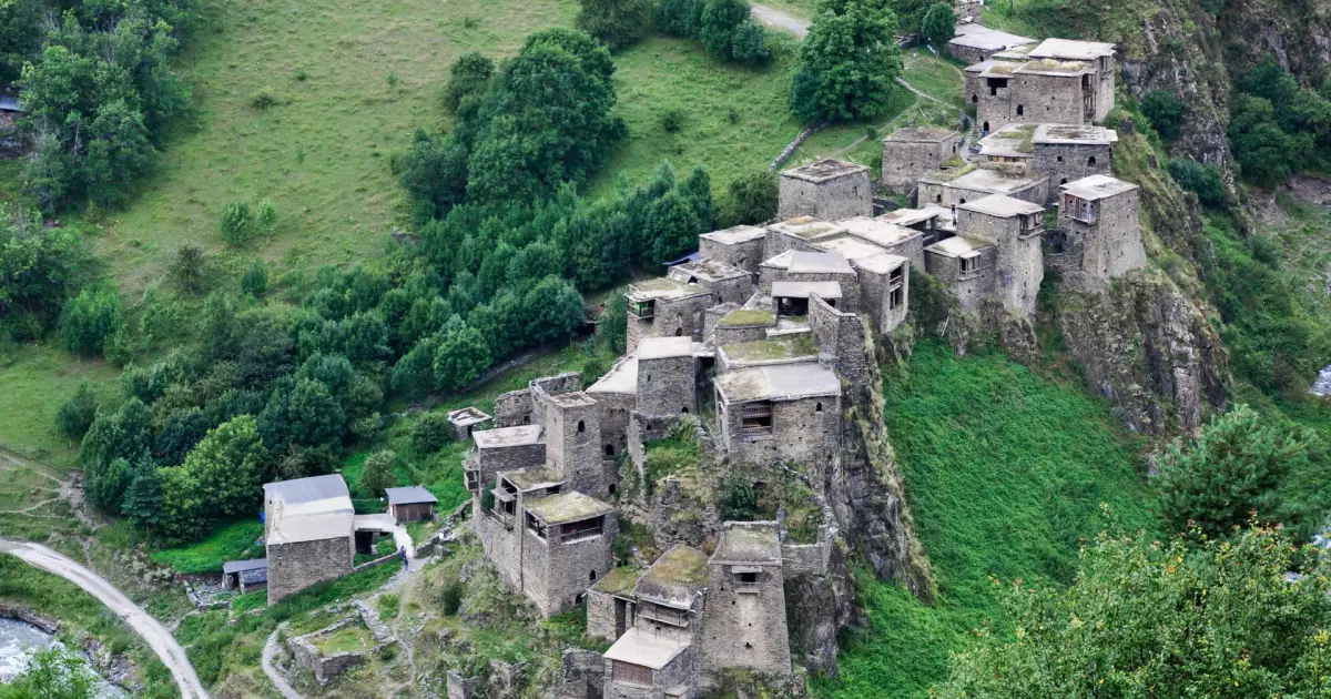
Shatili is most impressive at street level, where narrow passages, terraces and closely packed tower-houses reveal how residential and defensive functions were combined within one compact settlement.
Step back for the full village silhouette
A wider view from the valley makes the architecture easier to read than any single tower. The settlement climbs the slope as one dense mass rather than as separate farmsteads.
Use the village as a base for the Arghuni valley
Shatili is also the practical staging point for Mutso, Anatori and longer Khevsureti walks, which is why an overnight usually makes more sense than returning toward Tbilisi the same day.
Shatili: facts that add context to the visit
The settlement functioned as both village and fortress
Shatili guarded approaches from the north while remaining a residential community, with towers and domestic spaces woven into the same defensive fabric.
Around sixty towers and fortified dwellings shape the complex
The dense cluster covers only a small area, which helps explain why internal passages and connected roofs were so useful to residents during periods of danger.
Shatili stands at roughly 1,400 meters
The high valley location contributes to the severe winter conditions and the seasonal character of road access in Khevsureti.
The village is on Georgia's UNESCO Tentative List
Shatili was submitted to the World Heritage Tentative List in 2007 as a cultural property; tentative status is not the same as full World Heritage inscription.
Where is Shatili?
Shatili is in Mtskheta-Mtianeti, with the map pin at approximately 42.658890, 45.157780. Use the location map for route planning rather than estimating travel from the name of the nearest town alone.
Things to see near Shatili
Mutso
Restored fortress-village farther up the Andaki valley.
Anatori crypts
Historic burial structures on the road between Shatili and Mutso.
Datvisjvari Pass
High road pass with major views on the approach to northern Khevsureti.
Pshav-Khevsureti National Park
Protected mountain landscape surrounding many of the region's routes.
Arghuni valley
River corridor connecting the fortified villages and hiking routes.
Planning the visit
- Treat road access as seasonal and condition-dependent; check locally before departure rather than relying on an old timetable or map estimate.
- Plan at least one night in Khevsureti if you want to include Mutso or nearby hiking without spending most of the day in transit.
- Bring cash, warm layers and basic supplies appropriate for a remote mountain village where services are much more limited than in Kazbegi or Gudauri.
Use Khevsureti / Tbilisi as the accommodation starting point.
Compare real directory listings by map position and current booking source instead of choosing a room before you choose the route.
Booking.com links may earn Georgian Stays a commission at no extra cost to you.
Where the facts and image come from
Stable historical and geographic claims are checked against tourism, heritage or reference sources. Prices, opening hours and temporary access rules are deliberately not frozen into this article; use the current official source before travel.