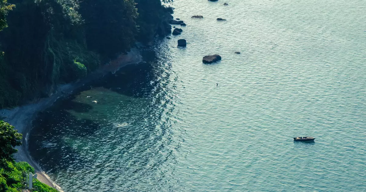
Why add Mtirala National Park to a Georgia itinerary?
Mtirala makes much more sense once you understand why the forest is so wet. The park sits where moisture from the Black Sea is trapped against the western Caucasus ranges, creating one of the rainiest landscapes in the region and the conditions that sustain its ancient Colchic forest. Use Batumi / Chakvi as the practical starting point, then check the exact map position before fitting the stop into a wider Adjara route.
How to plan Mtirala National Park into your route
Start with the site itself, then use the closest complementary stops to avoid a day of unnecessary backtracking. These three pairings are the most useful places to consider first.
Chakvi
Coastal town and practical road gateway to the park.
Batumi Botanical Garden
Subtropical plant collections on Green Cape north of Batumi.
Batumi
Main accommodation and transport base for most visitors.
How Mtirala National Park became the place you see today
Mtirala makes much more sense once you understand why the forest is so wet. The park sits where moisture from the Black Sea is trapped against the western Caucasus ranges, creating one of the rainiest landscapes in the region and the conditions that sustain its ancient Colchic forest.
The Black Sea and mountains create Mtirala's defining microclimate
Moist air moving inland from the Black Sea is forced upward by the surrounding mountain ranges. As the air rises it cools and releases heavy precipitation. UNESCO's nomination material records exceptionally high rainfall around Mount Mtirala, while Georgia Travel describes the mountain as receiving more than four metres of precipitation in a typical year.
That explains the name: “Mtirala” is commonly translated as “weeping.” The cloud, mist, streams and constantly damp vegetation are not incidental weather; they are the environmental process that shapes the whole visit.
The forest belongs to an ancient Colchic ecosystem
The Colchic rainforests are among the oldest temperate broad-leaved forest systems in western Eurasia. Their importance comes partly from survival: humid refuges around the eastern Black Sea allowed forest communities and relict species to persist through major climatic changes that transformed much of Europe and western Asia.
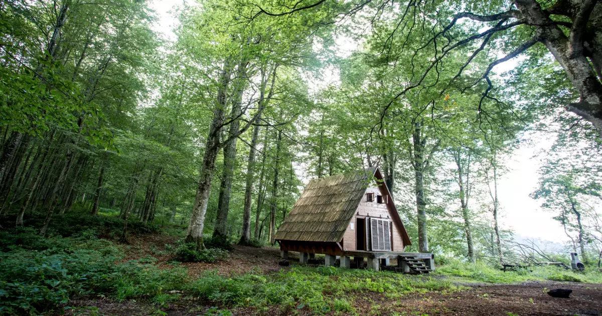
This is why Mtirala feels unusually dense even compared with other green mountain areas in Georgia. Evergreen understorey grows beneath deciduous forest, and the narrow climatic range plus heavy rainfall supports a complicated mosaic of habitats.
A national park that became part of Georgia's first natural World Heritage site
Mtirala is managed as a national park with marked day and overnight routes, visitor infrastructure and protected forest. In 2021 the wider Colchic Rainforests and Wetlands property was inscribed on the UNESCO World Heritage List; the Kintrishi–Mtirala component is one of the mountain forest areas included in that serial site.
For visitors, that status is a useful reminder that the waterfall and trails are only the visible part of the story. The main attraction is the functioning rainforest ecosystem itself.
A bookable way to experience Adjara
We only add an activity recommendation where it improves the route rather than duplicating something that is easier to visit independently. Check the live product page for the current operator, price, inclusions and cancellation terms before booking.
 Adjara
Mtirala National Park hiking tour from Batumi
Mtirala is one of the best contrasts to Batumi: humid forest, river crossings, waterfalls and a real walking component. The guided option removes the transport friction from a half-day nature escape.
Mtirala is part of a UNESCO serial World Heritage property
The Colchic Rainforests and Wetlands World Heritage property, inscribed in 2021, includes protected forest components in western Georgia including Mtirala.
Trip.com has a dedicated Mtirala outing with Batumi pickup, forest hiking, the waterfall and lake, making it a useful provider comparison for this exact nature day.
What to see at Mtirala National Park
I would not rush straight to the most photographed angle. These are the details that make the visit more useful once you are actually there.
Start at the Chakvistavi visitor area
The park's visitor infrastructure helps travelers choose between shorter day walking and longer routes before entering the forest.
Walk toward Tsablnari waterfall and forest viewpoints
The short-route scenery combines dense Colchic vegetation, stream crossings and waterfall terrain rather than open alpine hiking.
Notice how quickly the coast disappears
Although Mtirala is close to Batumi, the humid forest and mountain relief feel markedly different from the Black Sea promenade and resort landscape.
Mtirala National Park: facts that add context to the visit
Mtirala protects part of the Colchic forest ecosystem
The park lies in one of the wettest parts of the Caucasus, which supports the lush evergreen and deciduous vegetation that defines the visit.
The park was established in the 2000s
Georgia's Agency of Protected Areas manages Mtirala as a national park with marked visitor routes and designated recreation infrastructure.
Trails range from day walks to overnight routes
Official park information describes one- and two-day options, with picnic, camping and shelter facilities associated with the longer route network.
Mtirala is part of a UNESCO serial World Heritage property
The Colchic Rainforests and Wetlands World Heritage property, inscribed in 2021, includes protected forest components in western Georgia including Mtirala.
Where is Mtirala National Park?
Mtirala National Park is in Adjara, with the map pin at approximately 41.684194, 41.859856. Use the location map for route planning rather than estimating travel from the name of the nearest town alone.
Things to see near Mtirala National Park
Chakvi
Coastal town and practical road gateway to the park.
Batumi Botanical Garden
Subtropical plant collections on Green Cape north of Batumi.
Batumi
Main accommodation and transport base for most visitors.
Kobuleti
Black Sea resort town north of Chakvi.
Machakhela
Another forested protected landscape south-east of Batumi for a longer nature-focused trip.
Planning the visit
- Expect mud and wet vegetation even when the coast is warm and dry; footwear matters in this very humid mountain environment.
- Check the visitor center or protected-areas information before committing to a longer trail because weather can change route conditions quickly.
- Use Batumi or Chakvi as the base unless you are specifically planning an overnight trek inside the park.
Use Batumi / Chakvi as the accommodation starting point.
Compare real directory listings by map position and current booking source instead of choosing a room before you choose the route.
Booking.com links may earn Georgian Stays a commission at no extra cost to you.
Where the facts and image come from
Stable historical and geographic claims are checked against tourism, heritage or reference sources. Prices, opening hours and temporary access rules are deliberately not frozen into this article; use the current official source before travel.