Why add Dashbashi Canyon to a Georgia itinerary?
Dashbashi differs from many of western Georgia's famous canyons because the river has cut through a volcanic plateau rather than a classic limestone karst landscape. The geology helps explain the dark rock walls, abrupt gorge and cool, wet microclimate below the rim. Use Tsalka as the practical starting point, then check the exact map position before fitting the stop into a wider Kvemo Kartli route.
How to plan Dashbashi Canyon into your route
Start with the site itself, then use the closest complementary stops to avoid a day of unnecessary backtracking. These three pairings are the most useful places to consider first.
Dashbashi village
Village and St George Church close to the canyon.
Tsalka Reservoir
Large highland reservoir nearby.
Bareti Lake
Small high-altitude lake in the Tsalka area.
How Dashbashi Canyon became the place you see today
Dashbashi differs from many of western Georgia's famous canyons because the river has cut through a volcanic plateau rather than a classic limestone karst landscape. The geology helps explain the dark rock walls, abrupt gorge and cool, wet microclimate below the rim.
The river carved through volcanic rocks of the Tsalka plateau
Over time the Khrami river system and its tributaries cut downward through volcanic plateau rocks, exposing layers and creating the steep-sided canyon. Springs and small waterfalls emerge along the walls where groundwater finds routes through the rock.
The natural monument and the modern bridge are not the same thing
The canyon is a protected natural landscape. The glass Diamond Bridge is a much newer commercial visitor attraction spanning the gorge. Keeping those two stories separate makes planning clearer: trail conditions, natural-monument information and bridge operations can have different rules and schedules.
Descending into the gorge changes the environment quickly
The plateau rim is open and exposed, while the canyon floor is cooler, shaded and wetter. That sharp contrast is part of what makes the walk worthwhile even for visitors who are less interested in the bridge itself.
A bookable way to experience Kvemo Kartli
We only add an activity recommendation where it improves the route rather than duplicating something that is easier to visit independently. Check the live product page for the current operator, price, inclusions and cancellation terms before booking.
 Kvemo Kartli
Dashbashi Canyon & Diamond Bridge adventure
Dashbashi works well as a dedicated outing because the canyon, waterfalls and Diamond Bridge occupy the same destination. A group transfer removes the least interesting part of the day: arranging the long out-and-back transport yourself.
The river cuts through volcanic plateau rocks
The geology distinguishes Dashbashi from western Georgia's limestone canyons.
Trip.com has a direct day-tour option from Tbilisi centered on Dashbashi Canyon and the Diamond Bridge, closely matching the route recommended here.
What to see at Dashbashi Canyon
I would not rush straight to the most photographed angle. These are the details that make the visit more useful once you are actually there.
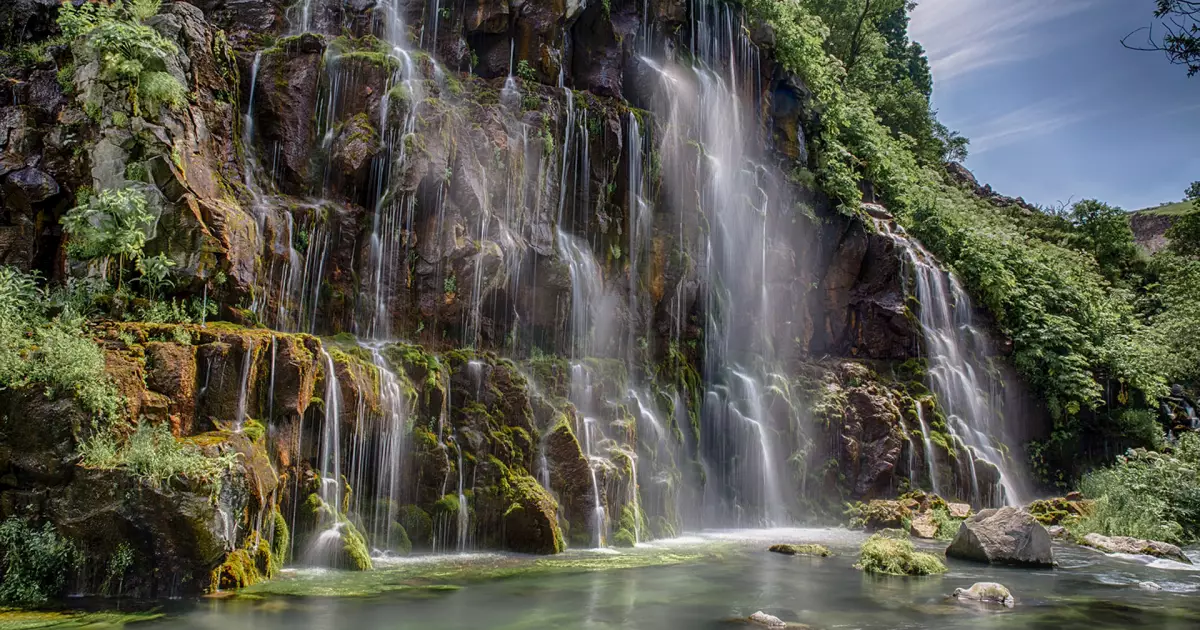
Descend toward the canyon and waterfalls
The official visitor route drops from the plateau into a cooler, greener environment shaped by springs and waterfall walls.
See the glass bridge in landscape context
The modern bridge is visually dominant, but the natural monument below it is the reason the site matters: a deep river gorge cut into volcanic rock.
Notice the microclimate change
Vegetation becomes noticeably lusher on the canyon slopes and floor than on the exposed plateau above, making the descent part of the sightseeing experience.
Dashbashi Canyon: facts that add context to the visit
The protected natural monument covers about 669 hectares
Agency of Protected Areas data treats the canyon as a substantial landscape rather than only the bridge attraction.
The terrain spans roughly 1,110–1,448 meters elevation
The sharp vertical range contributes to local temperature and vegetation differences.
The river cuts through volcanic plateau rocks
The geology distinguishes Dashbashi from western Georgia's limestone canyons.
The official waterfall route is about 1.8 km
Georgia's protected-areas information describes roughly an hour for the return walk, though actual pace depends on conditions.
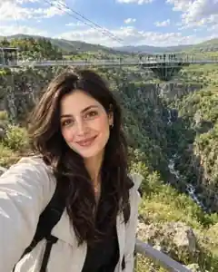
The glass bridge is about 240 meters long
The newer visitor attraction spans the gorge and includes a central suspended structure, but access conditions and commercial operations can change.
Where is Dashbashi Canyon?
Dashbashi Canyon is in Kvemo Kartli, with the map pin at approximately 41.594194, 44.124306. Use the location map for route planning rather than estimating travel from the name of the nearest town alone.
Things to see near Dashbashi Canyon
Dashbashi village
Village and St George Church close to the canyon.
Tsalka Reservoir
Large highland reservoir nearby.
Bareti Lake
Small high-altitude lake in the Tsalka area.
Kldekari Fortress
Historic mountain-fortress landscape on a broader Kvemo Kartli route.
Samshvilde
Historic fortified settlement and canyon landscape farther south-east.
Planning the visit
- Check current conditions before descending because the canyon route involves elevation and can be affected by weather.
- Tsalka has limited public accommodation inventory in our directory, so compare the broader Kvemo Kartli region as well.
- Separate natural-monument information from bridge-operator marketing when checking prices, hours and temporary activities.
Use Tsalka as the accommodation starting point.
Compare real directory listings by map position and current booking source instead of choosing a room before you choose the route.
Booking.com links may earn Georgian Stays a commission at no extra cost to you.
Where the facts and image come from
Stable historical and geographic claims are checked against tourism, heritage or reference sources. Prices, opening hours and temporary access rules are deliberately not frozen into this article; use the current official source before travel.